island fahne

island - sommer 2012

island fahne

montag, 16-juli-2012: arnarstapi, IS - olafsvik, IS
kilometerzähler: 71 km (GPS: 74 km)

arnarstapi - snaefellsjoekull:

wegstrecke der fahrt von arnarstapi zum snaefellsjoekull snaefellsjoekull parkplatz songhellir caves

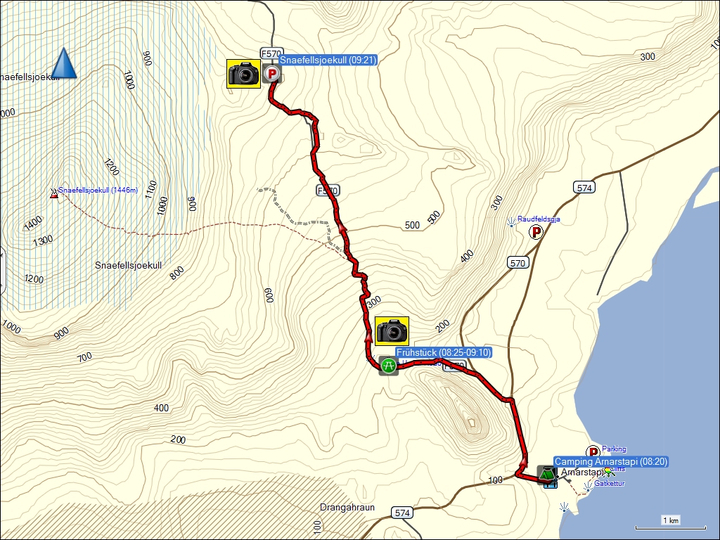
fahrt von arnarstapi zum snaefellsjoekull (9 km / 9 km).

hoehenprofil fahrt von arnarstapi zum snaefellsjoekull

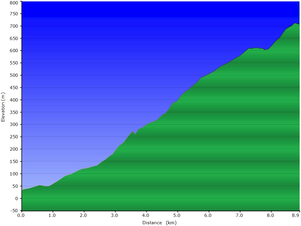
höhenprofil der fahrt von arnarstapi zum snaefellsjoekull.


snaefellsjoekull:

wegstrecke wanderung zum snaefellsjoekull snaefellsjoekull mittagrast gipfel des snaefellsjoekull snaefellsjoekull schneefeld snaefellsjoekull parkplatz

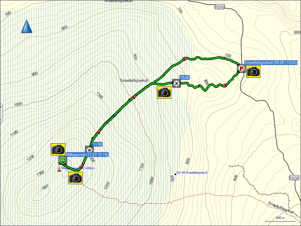
wanderung zum snaefellsjoekull (8.4 km).

hoehenprofil wanderung zum snaefellsjoekull

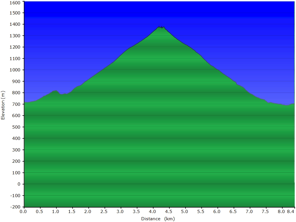
höhenprofil der wanderung zum snaefellsjoekull.


snaefellsjoekull - olafsvik:

wegstrecke fahrt vom snaefellsjoekull nach olafsvik campingplatz olafsvik snaefellsjoekull

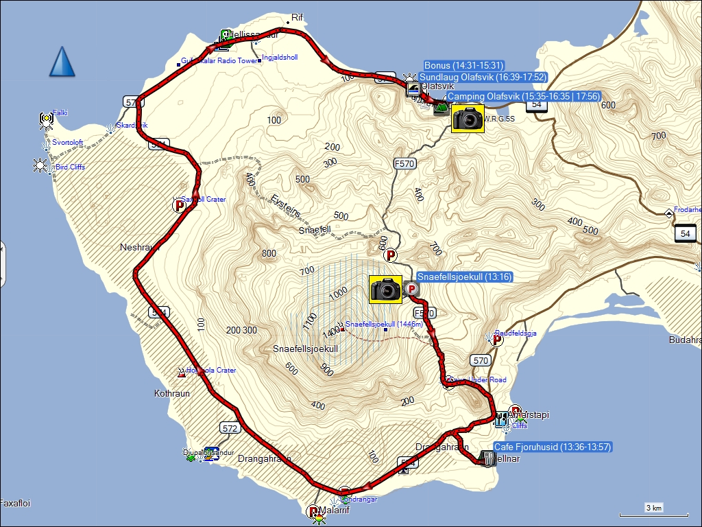
fahrt vom snaefellsjoekull nach olafsvik (61 km / 64 km).

hoehenprofil fahrt vom snaefellsjoekull nach olafsvik

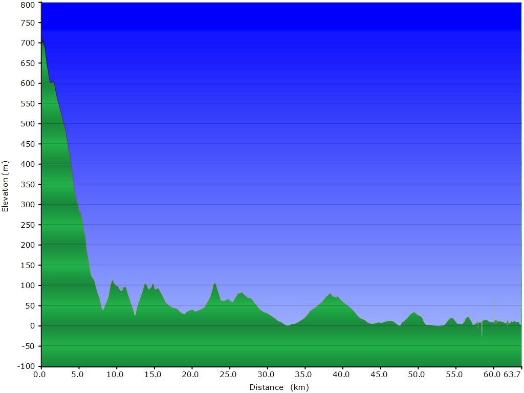
höhenprofil der fahrt vom snaefellsjoekull nach olafsvik.

die GPS-empfänger wurden zur verfügung gestellt von TRAMsoft GmbH.

gestern | tagebuch | inhaltsverzeichnis | übersichtskarte | morgen


karte.html | 31-aug-2012 | the ambis